

After enjoying the incredible beauty of Crater Lake, I headed to the Rogue-Umpqua Scenic Byway (OR-138), also known as the “Highway of Waterfalls.” This 172-mile byway ascends from Interstate-5 into the southern Cascades, tracking two of Oregon's most storied rivers. The first leg of the trip follows the North Umpqua east from Roseburg. A river of unparalleled beauty, the North Umpqua is revered worldwide for its steelhead fishing. After passing more than a half dozen waterfalls, the byway reaches sparkling Diamond Lake, at the base of Mount Thielsen. The byway then bends south, and soon follows the "Wild and Scenic" Rogue River. I've read that there are fifteen waterfalls along the Rogue-Umpqua Scenic Byway, so if you're a waterfall chaser like me, this could be the adventure you're looking for in the Southern Oregon region!
I only traveled the part from Crater Lake to Roseburg and managed to see four of the waterfalls en route in the few hours I had. It was a hot day in the mid-90’s, which was one of the factors for how many hikes I was able to do on June 1, 2021. I think I would have managed a few more stops and hikes if the weather had been cooler.
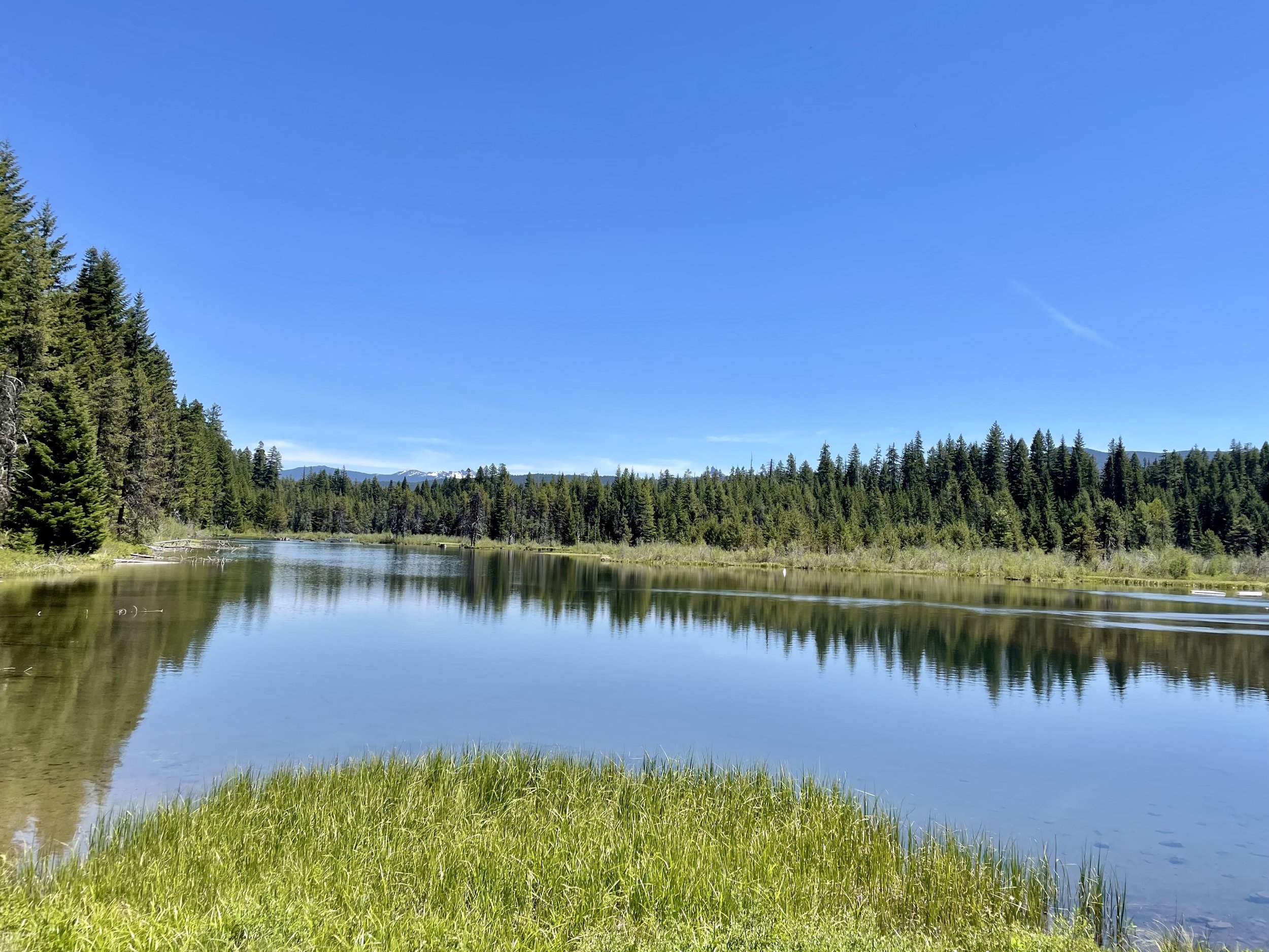
Since I was traveling from east to west, my first stop was Diamond Lake, a natural lake situated in the heart of the Cascade Mountains and surrounded by stunning natural beauty. The lake is named after its crystal-clear waters that sparkle like diamonds in the sunlight. The lake is located at an elevation of 5,183 feet above sea level and covers an area of 2,824 acres, making it one of the largest natural lakes in Oregon. It was formed as a result of glacial activity during the last Ice Age and is fed by several streams and is drained by the North Umpqua River. It’s a great place for fishing, boating, camping, and snowmobiling with various lodging options (resort, campground, RV park). I plan to camp here some day in the future as that water sure looked inviting!


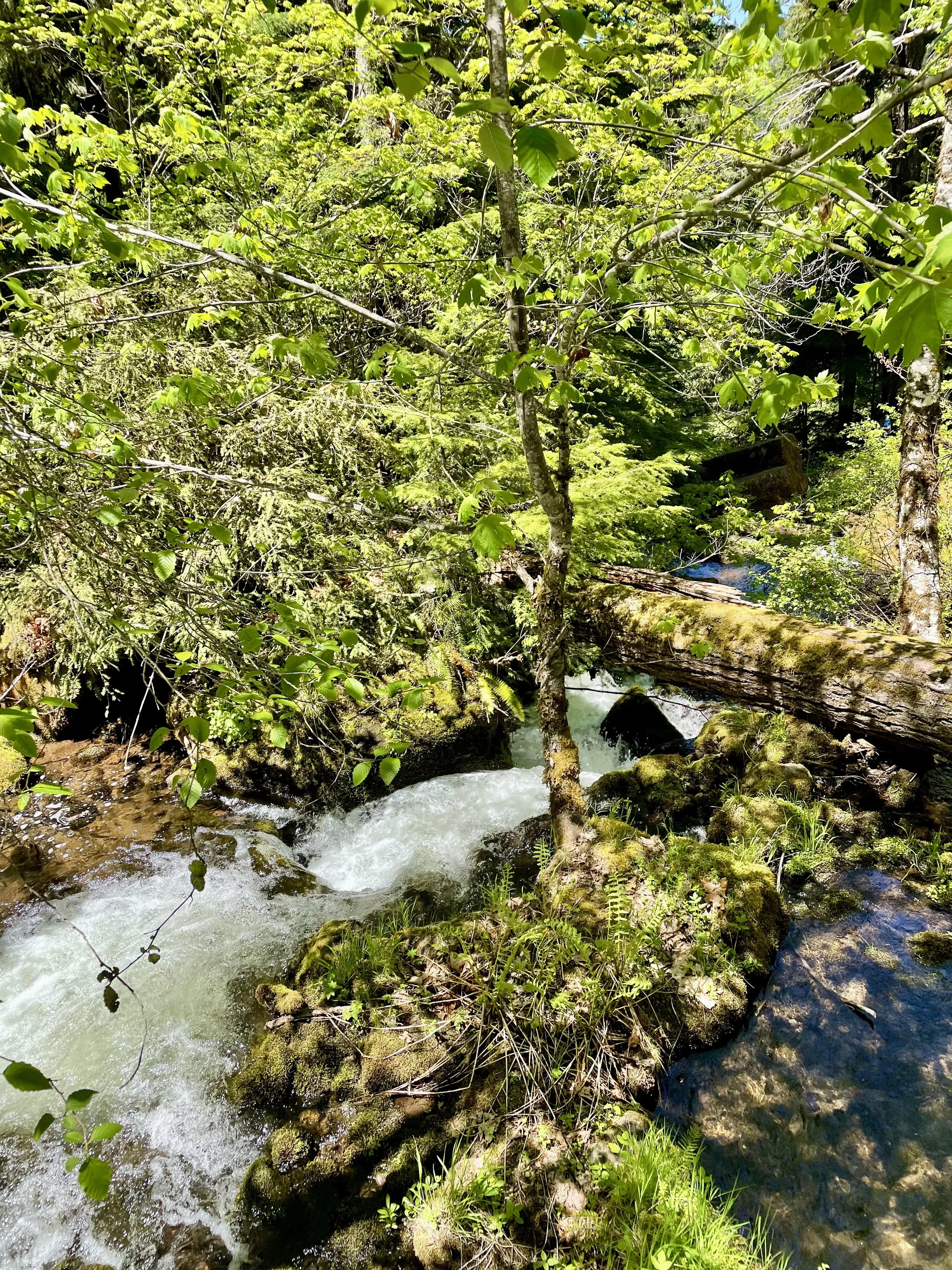
After soaking in the views at Diamond Lake, I started my waterfall chase. First up was Clearwater Falls, which is a quick stop off the highway with the viewing platform for the falls is just steps from the parking lot. The Clearwater River is fed by a spring not too far upstream from here, so the falls are fairly consistent in flow throughout the year, cascading 30 feet over moss covered rocks and fallen logs. There are picnic tables there, so it’s a nice spot to take a break and relax. There’s also a campground there that is open seasonally for $10.


I made a quick stop at Stump Lake between Clearwater and Whitehorse Falls to see what this 10-acre lake was all about. Turns out it’s a popular birding and fishing spot, stocked with brook trout.
Next up was Whitehorse Falls, a beautiful small 15 feet waterfall also located on the Clearwater River that tumbles into a small pond. Like Clearwater Falls located further upstream, Whitehorse Falls is not a large or impressive waterfall when compared with others nearby, but the tranquility of the area and the beautiful old growth Douglas fir forest found here make it a worthwhile stop. Plus it’s a short 0.1 mile walk through some tree cover to see the falls. There is also a seasonal campground at this location for $10.


Watson Falls, often touted as Oregon's 3rd tallest waterfall, are actually further down the list per Northwest Waterfall Survey, but its impressive 294-foot continuous drop gives it a lot of clout! There are two viewpoints along this 1 mile, family friendly loop trail which has about 425 ft elevation gain through old-growth forest. You can feel the mist of the falls at the upper viewpoint, so watch your footing as some of the rocks can be a bit slippery. I really enjoyed the hike through the old growth forest and seeing all the little falls along the stream as well. From the parking lot you can also access Watson Creek and dip your feet into the cool water. Sadly the bathroom and parking lot were strewn with litter, which was beyond disappointing to see, once again reminding me that humanity doesn’t always appreciate and respect public places and realize their impact on the environment.


My last waterfall hike of the day was Toketee Falls, the best-known waterfall on the North Umpqua River. Once you park your vehicle, you’ll notice a long pipeline along the road. This 12-foot diameter redwood-stave flowline was constructed in 1949 as part of the North Umpqua Hydroelectric Project. The water that flows through the pipeline still powers three generator turbines, producing energy for 22,500 homes.Despite only being 1 mile in and out, the trail to the falls does involves a series of almost 200 steps along the side of the canyon (about 200 ft elevation gain), ending at the viewpoint platform above the chasm of the amphitheater constructed of columnar basalt. Two tiers are visible from the viewpoint, the 80-foot lower plunge and a 40-foot upper falls, with a third tier invisible to viewers up the narrow defile of giant potholes above the main falls. Toketee (pronounced TOKE-uh-tee) is a Chinook jargon word meaning "pretty" or "graceful" which describes these falls perfectly! I did notice that a bunch of people were scrambling down the side of the canyon from the viewing platform so they could get into the pool of water, but there are many warning signs posted about the dangers of doing that. I highly encourage my readers not to follow suit as all that trampling is just eroding the ground and destroying the vegetation, in addition to being very unsafe. Practice “leave no trace” principles wherever you go and stay on trails!


If you ever drive this scenic highway, I highly recommend stopping at all the falls. Even though I didn’t do them all, there are quite a few more worth checking out: Warm Spring Falls, Lemolo Falls, Steamboat Falls, Fall Creek Falls, Deadline Falls, and Susan Creek Falls. For all you fishing enthusiasts, Swiftwater Recreation Area is a good place to go for steelhead and salmon fishing. Plus I know I plan to go to Umpqua Hot Springs next time I’m in the area! Watch the video in this guide to get some inspiration on where to camp while in the area seeing the falls!
My trip from Washington to Northern California and back through Oregon is almost done with one post left about some waterfalls hikes near Vancouver, Washington!