
Back in May 2021, I went out a fun journey to Utah for the inaugural VanFest. I had big plans to meet up with my friend Ricardo and caravan through a lot of the national and state parks/monuments in Utah and even get to the North Rim of the Grand Canyon, but he sadly couldn’t commit to week long road trip. I still planned to explore solo, but the universe had a different plan for me and the adventure I went on was still amazing and unforgettable!
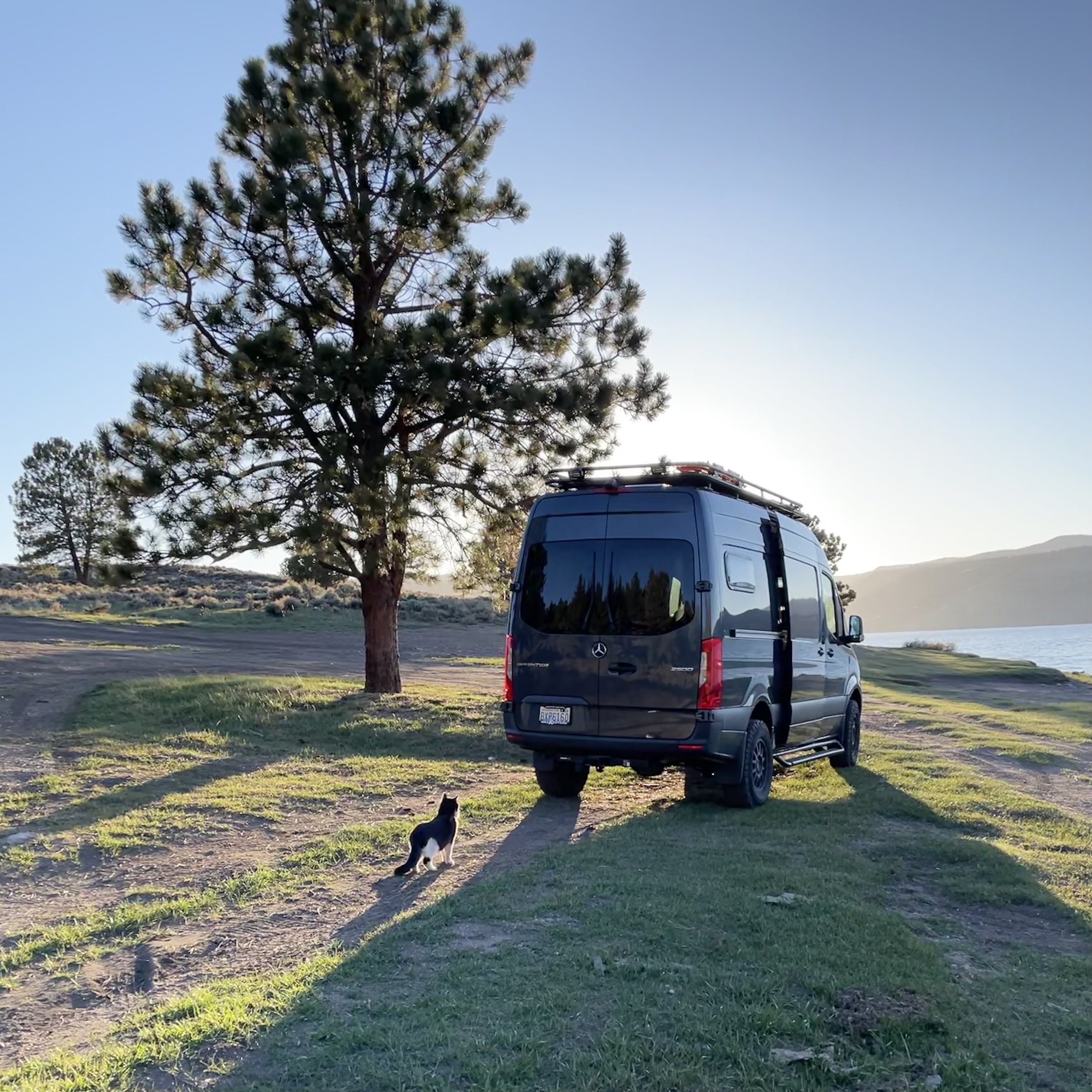
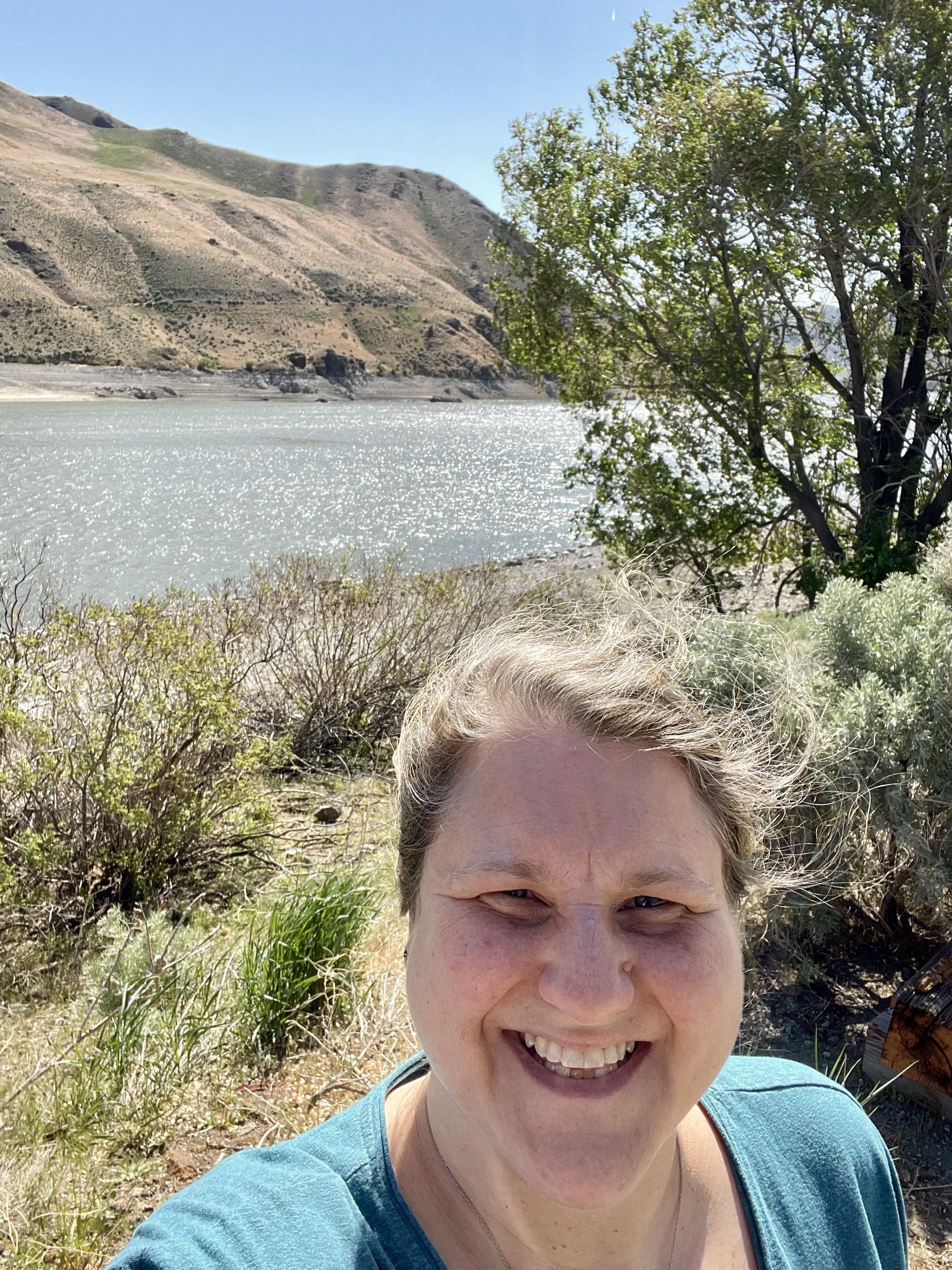
My trip started on May 2 and took me from my home base in Bellingham over Snoqualmie Pass into Eastern Washington and through Yakima, the “Palm Springs of WA,” and then south into Oregon over the Columbia River at Umatilla. One highlight was coming down I-82 after passing Yakima and seeing both Mount Rainier to the north and Mount Adams to the south towering in the distance. I stopped quickly at Selah Creek Rest Area where I took some great photos of the valley below, then headed on. I found a wonderful camping spot called Spring Recreation Site along the Browlee Reservoir, a 52-mile long reservoir on the Snake River. Campsites there are only $5/night, though if you have an America Is Beautiful pass, it’s half that. For those of you that don’t care to have a paid campsite, there’s quite a few pullouts along the road you can overnight at for free instead.


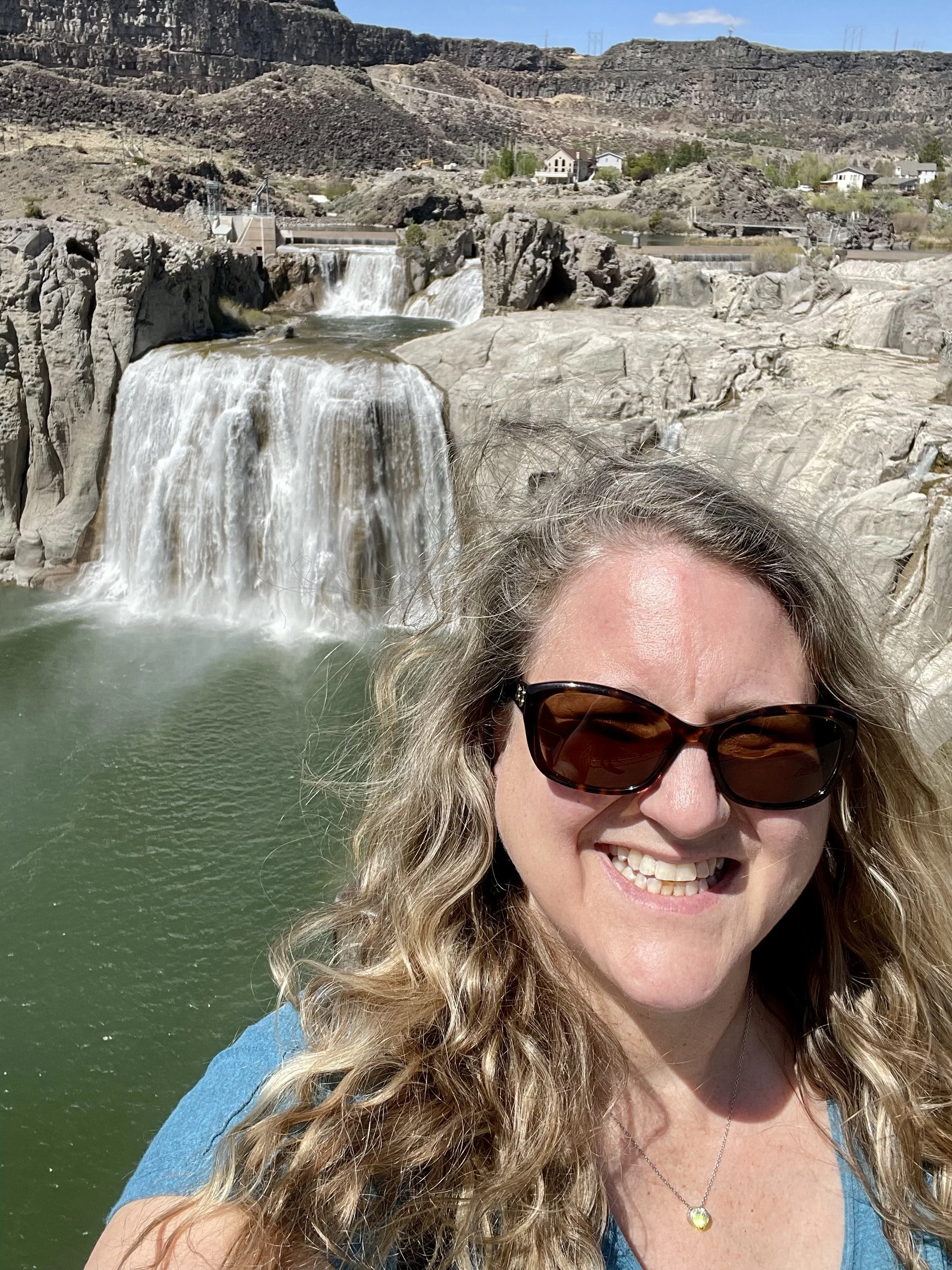
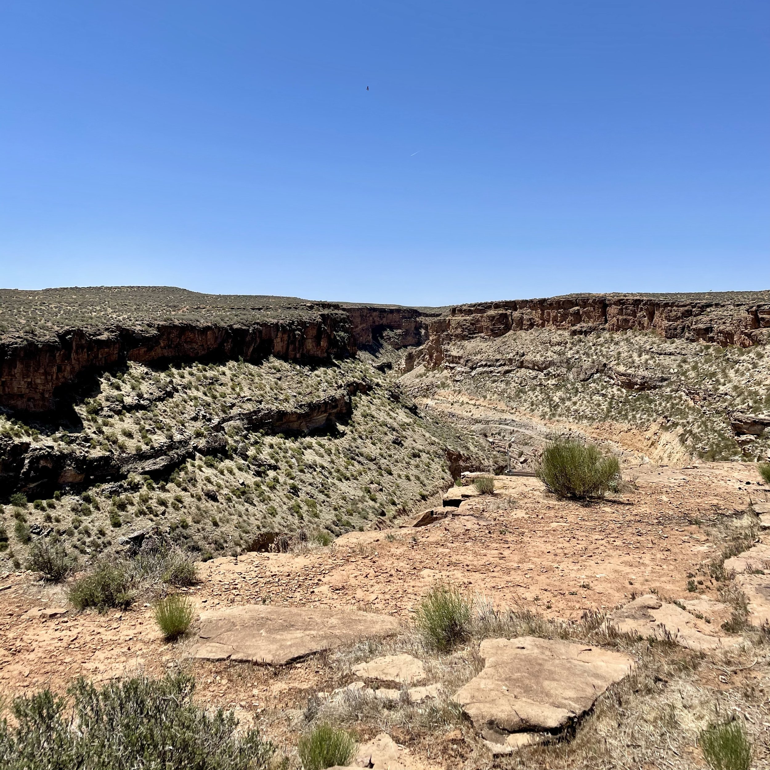
The next morning I crossed into Idaho, my first time in this state, and drove through Nampa and Boise. I heard that Twin Falls was a must-see spot, so I took the small detour to check it out. I was pretty blown away by this lovely city along the Snake River Canyon and even more impressed by Shoshone Falls, the “Niagara of the West”! Shoshone Falls is 212 feet (65 m) in height, 45 feet (14 m) higher than Niagara Falls and flows over a rim nearly one thousand feet (300 m) in width. Luckily it was not a busy day so I didn’t have to battle any crowds while taking photos at all the viewpoints. I also stopped at Dierkes Lake, a popular swimming and fishing hole less than a mile up the road. I hope to spend more time in Southern Idaho in the future because there are actually over 30 waterfalls in the “City of Waterfalls” and even more in the surrounding region, including Perrine Coulee, Pillar Falls, Auger Falls, Twin Falls, Mermaid Cove, Cauldron Linn (Lynn), Ross Falls & Phantom Falls.


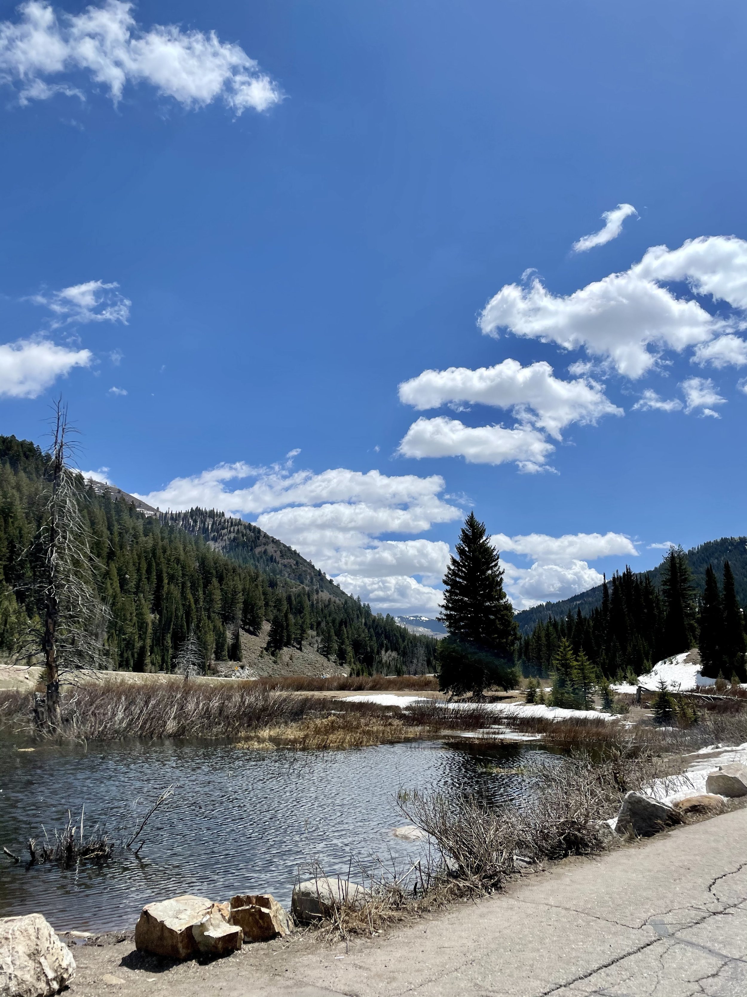
After my afternoon visit to Twin Falls, I headed south into Utah and stopped in Salt Lake City for the night to visit my friend Wayne. He drove me around his city right during the golden hour which really lights up Mount Olympus and the Wasatch Range. The clouds turned a lovely shade of pink that night as we ate dinner and hung out at his fire pit. I had read about Big & Little Cottonwood Canyons and decided to explore those the next morning. Big Cottonwood Canyon is a 15-mile scenic drive and home to two world-class ski resorts (Solitude & Brighton), legendary rock climbing routes, epic backcountry skiing access, hiking and mountain biking trails, and picnic areas straight out of an outdoor magazine. Little Cottonwood Canyon is the 7-mile “littler" scenic drive and home to world famous Snowbird and Alta ski resorts, as well as the Albion Basin, which encompasses Alta and is famous for its wildflowers, making it one of the most photographed areas in northern Utah.


I read that Donut Falls was an easy waterfall hike within Big Cottonwood Canyon, so I decided to stop and take the trail. The waterfall gets its name from a donut-hole shape in the rock. The falls pours through the hole into a small pool in a cave before trickling down the rocks. Normally this is an easy 1.5 mile trail, but during the winter the gate is closed to get to the starting point, so you have to park at the Mill D Trailhead, which adds roughly a mile round-trip to the hike. Since the weather was warm and sunny, I didn’t expect the trail to be covered in snow, but luckily I had my trekking poles with me! The hike ended up being quite the feat in the snow without spikes on my shoes; I even fell and slid on my ass and got all muddy, and the last part uphill to get to the falls required knee-deep steps with my poles supporting me the whole way. Sadly the snow covered a lot of the donut hole so one couldn’t get the full waterfall view and experience, but I was still proud of my first hike in the snow! I have since learned to carry micro spikes for my hiking shoes with me in the van.


While looking for a cool overnight spot, I found some spots along Highway 92 on iOverlander, an app I use fo find off-grid boondocking spots, and decided to head there. It seemed liked another cool mountain road to explore that would take my through Robert Redford’s Sundance and Provo Canyon the following day. What I didn’t know was that this road is closed during the winter or when snow hasn’t fully melted yet. I got about a third of the way there when I hit the road closure and had to turn around. The one good part was that there was a stunning viewpoint there but sadly I didn’t take any photos. Maybe another time I can take the Alpine Loop Scenic Drive along Mount Timpanogos and stop to see Timpanogos Cave National Monument. I ended up in the Cedar Hills area for the night, parked along farmland and enjoyed a peaceful nights rest.


My buddy Wayne recommend I ditch I-15 South and take Heritage Highway 89 instead on my way to Southwest Utah, so I did exactly that! I didn’t make all the stops that this article recommends, but I did enjoy seeing the countryside and valleys this route offers. I was intrigued by Panguitch Lake and decided to check it out and see if it was a viable place to spend the night. This lake has 10 miles of shoreline and is a popular fishing spot. Its name comes from the Paiute Native American word for “big fish” which is most appropriate considering that trophy-sized trout averaging anywhere from 14-24” are caught there. The campgrounds weren’t open yet so I risked staying the night along the lakeshore and luckily wasn’t bothered. Fishermen were there early in the morning so I’m guessing they assumed I was one of them getting there at the crack of dawn to fish.


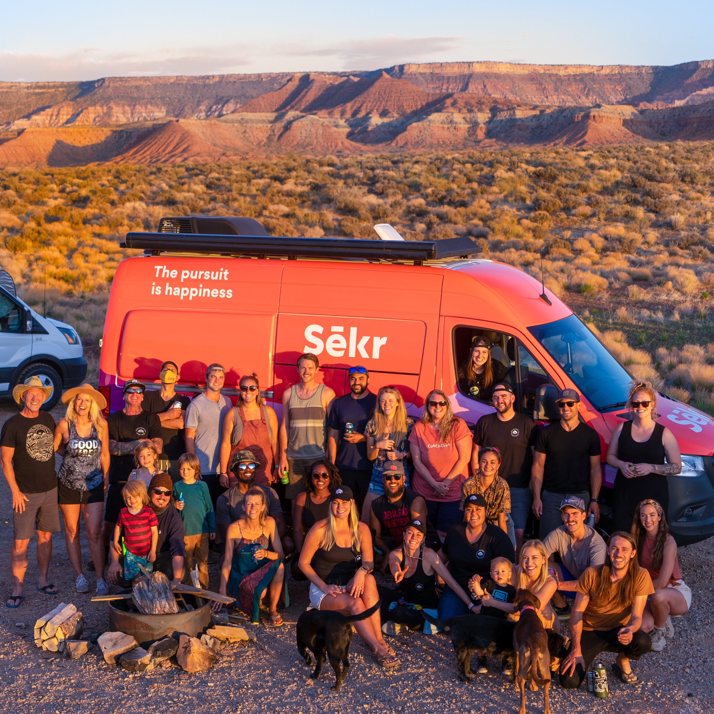
The next morning I headed towards Cedar City which by a happy coincidence took me by Cedar Breaks National Monument, a stunning “Circle of Painted Cliffs.” I really enjoyed viewing this 10,000 feet grand staircase that looks down into a half-mile deep geologic amphitheater, though I was limited to the overlook points as all the hiking trails were still closed due to the snow. Then I headed south through Toquerville and La Verkin and towards Zion where I was meeting up other overlanders for the Sēkr Kickoff Meetup in the desert along the Virgin River. About 40 people came together that evening to celebrate community, enjoy a food-truck catered meal, and participate in a “Hot Ones” spinoff that I participated in — the sauces got spicy and I made it to the end! That night was the first time I experienced the string of lights in the night sky from Starlink satellites which totally freaked some other nomads out.


The following day was prep day to get my van exhibit ready. Before heading to Washington County Legacy Park to get a good spot for the first ever VanFest, which was taking place the next day on May 8th, I went to one of those self-serve car washes in Hurricane and scrubbed my van clean since I was selected as one of their exhibiting vans. There was a small festival with live music and food trucks going on that afternoon and evening in the grass along the buildings, which many of the exhibitors enjoyed while getting to know one another and bonding. The next morning I cleaning the inside of my van, set up the back in the couch/lounge position, rolled and stuffed my memory foam mattress topper in my big storage cabinet, put all my bedding away, and oiled my counters so that my van looked perfect for the exhibition. I was really impressed with the set up — the exhibiting vehicles were in the main parking area, the sponsors in the adjoining lot, the attendees vehicles parked in rows in another section, and there was a huge stage for music with various bands throughout the whole day. I don’t know exactly how many people attended, but I do know that I had a steady stream of vanlife enthusiasts viewing my van and asking build questions, plus I enjoyed watching The National Parks band headline to a good-size audience. I learned how to ride an ebike that day courtesy of Storyteller Overland and their Super73. I also watched my first movie projected onto the side of a white van that night and witnessed a fabulous jam session with various nomadic musicians that went on late into the night. Not only did I get to hangout with some vanlife friends I’ve made in the past, but I also met some of the people I conversed with on the drop-in audio app Clubhouse, which was super cool. The whole festival was truly an unforgettable experience with some amazing people!


The day after VanFest was definitely a recovery day, hanging out with the Sēkr crew and getting to shower in their Airbnb before heading back to BLM land outside of Zion National Park to meet up with the new friends I made at VanFest that were planning to caravan around Utah. As I mentioned at the beginning of this blog post, I originally had planned to visit Zion, Bryce Canyon, Arches, Canyonlands, Capital Reef, Grand Staircase-Escalante, Glen Canyon, Moab, and Monument Valley but those plans changed because my friend bailed on me a few weeks before the trip. I figured that with this new group and some solo travel, I’d still be able to see some of those destinations, but that’s when things went a bit sideways for me.

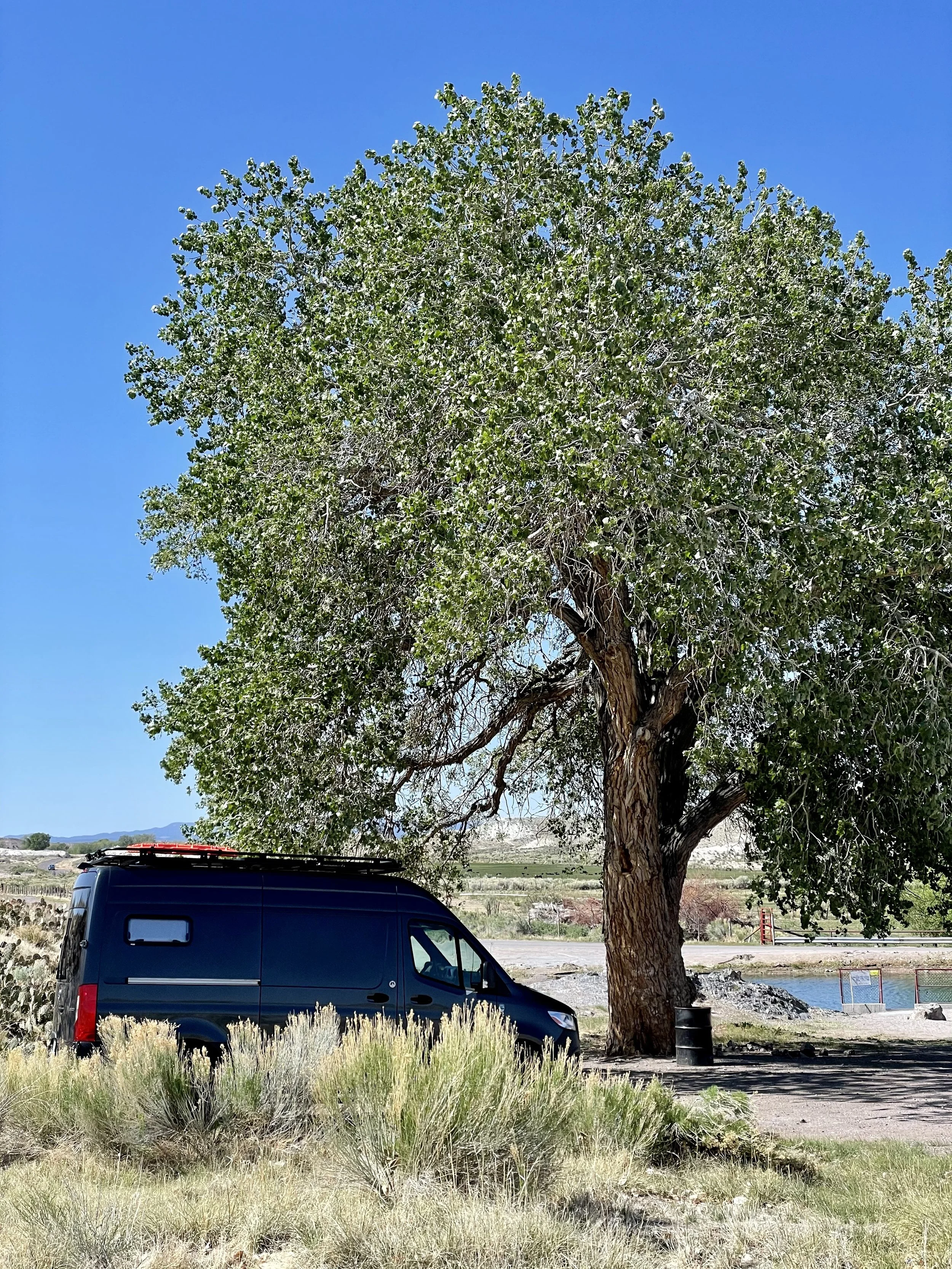
Those of you that really know me have often heard me say that I do not like hot weather — anything over 90*F is too hot for me. It just so happened that the beginning of May 2021 was super hot and getting hotter each day I was there. My weather app was predicting high 90’s/low 100’s at every park I planned to visit (except Bryce) and 112*F temps at Grand Canyon’s North Rim. I was already having a heard time with the heat in Southwestern Utah since I arrived and the idea of even higher temps was not sitting well with me. I don’t have air conditioning in the van and I was already super lethargic on May 9th. Late that afternoon and after much deliberation, I decided to change plans and head west into Nevada and towards the Eastern Sierra in California to meet up with my best buddy Eric. I said my goodbyes and took off early that evening and headed into Southeastern Nevada to a town called Panaca that has a warm spring I found on Google Maps. Enjoying a beautiful sunset during the drive, I arrived at Panaca Warm Spring in the dark and couldn’t quite tell if it was ok to park there overnight, but I decided to park my van near a tree in the dirt off to the side and away from the street and settle in for the night.
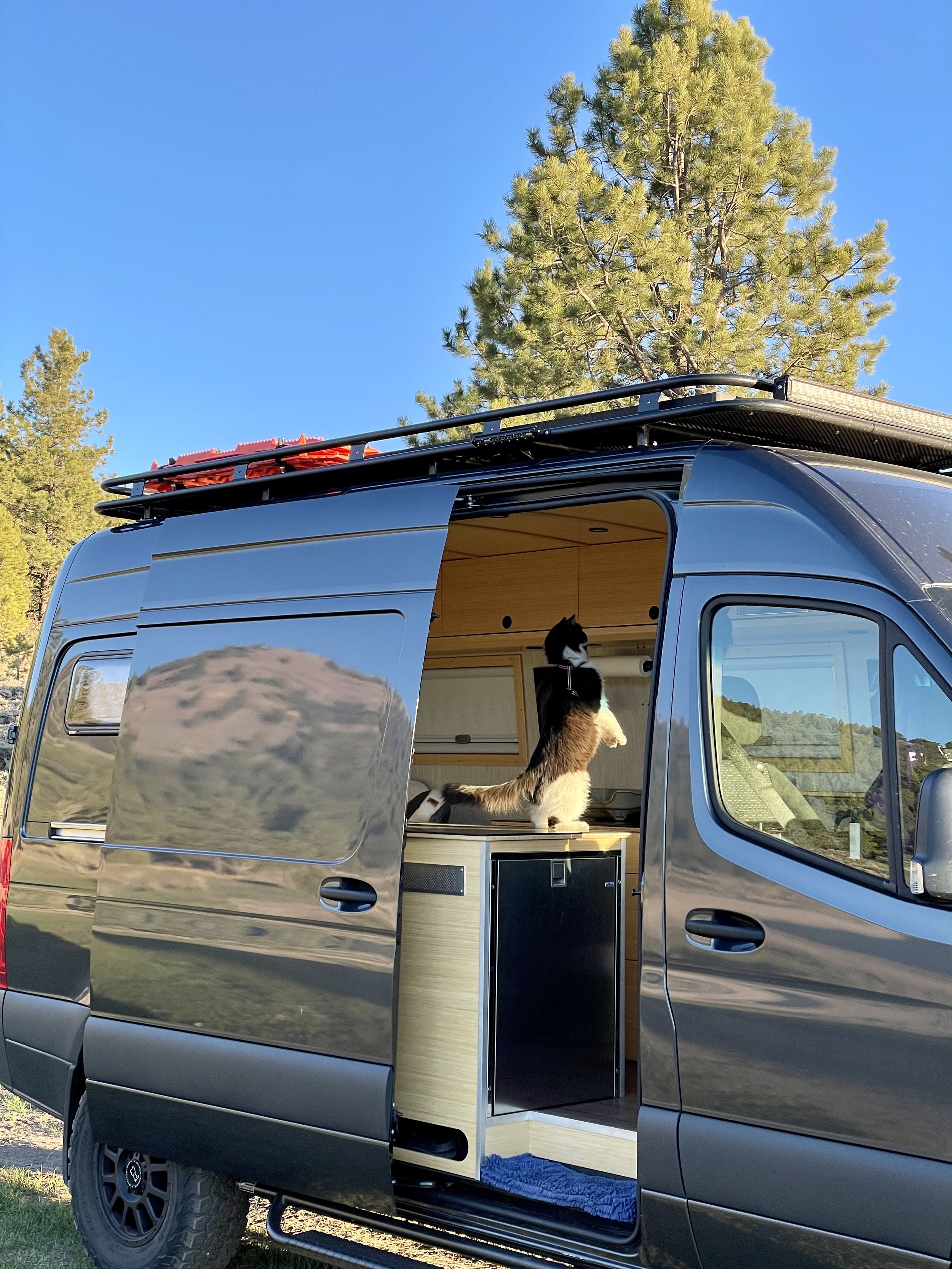
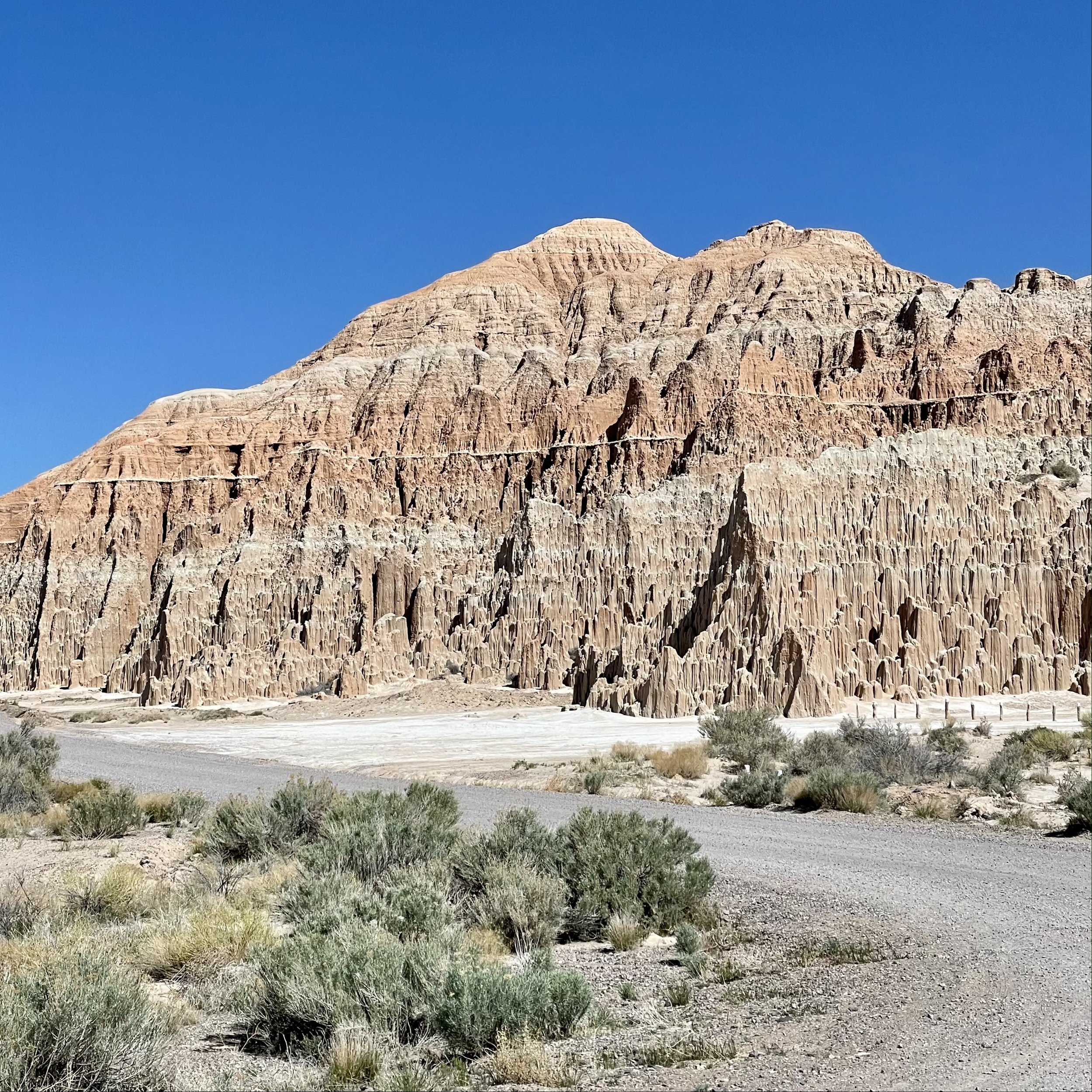
I was happy to wake up to some cooler temps the next morning. Surprisingly I was the only one there considering how nice Panaca Warm Spring is. This under-rated natural spring looks more like a pond with clear mid-80* temp water, a concrete dam on one end, and a staircase down for easy access. I enjoyed my time soaking in the temperate spring while my cat Maverick explored the vicinity. For those of you that like history, Panaca was the first permanent settlement by European Americans in southern Nevada, founded as a Mormon colony in 1864. It is one of two communities in Nevada that prohibits gambling and the only community in Nevada to be “dry” (forbidding the sale of alcoholic beverages). Having the place to myself was wonderful and the warm spring was beyond refreshing after my three days in the hot desert! I wanted to get to Mammoth quickly, so I left Panaca mid-morning and quickly drove through Cathedral Gorge State Park, a super cool spot where erosion has carved dramatic and unique patterns in the soft bentonite clay.


I headed east on Nevada State Route 375, better known as the Extraterrestrial Highway, a 98-mile stretch of road that runs alongside the famously secretive Area 51. Area 51 is the colloquial name of a highly classified United States Air Force facility that’s located within the Nevada Test and Training Range. I saw the sign that warned me that there’s no fuel along this highway, so I checked my gauge and it said I had more than twice as many miles left on my tank, so I headed into the Nevada desert. I had plans to stop in the very tiny town of Rachel and its famous cafe Little A’Le’Inn, as well as other landmarks to take photos, but what I didn’t expect to happen was tremendous headwind. About 30 minutes into the drive, I realized that my fuel range was rapidly decreasing and I started to get nervous. Driving through the desolate Nevada desert is an experience on its own without worrying about running out of fuel. The landscape is mainly mountains and joshua trees, which only grow in California, Arizona, Utah, Nevada, and Northwestern Mexico. Even though I knew there was a gas station in Rachel, I had a gut feeling it did not have diesel fuel. I decreased my speed to just under the speed limit for best fuel consumption and kept monitoring my fuel gauge and estimated miles left on the tank. Let’s just say that I watched my low fuel light come on, then a few miles before the town of Tonopah where I could refuel, the low fuel light started blinking like mad as the gauge went to zero. As this point I expected my van to stop and was prepared to walk the rest of the way to get diesel, but somehow Ardanwen my Sprinter chugged up that final ascend uphill and coasted into the first diesel station on its last fumes! I was relieved that i made it and learned my lesson to never attempt such foolishness in the future. On a side note, Tonopah is known for its rich history of silver mining and where many of the military men who work at Area 51 live.


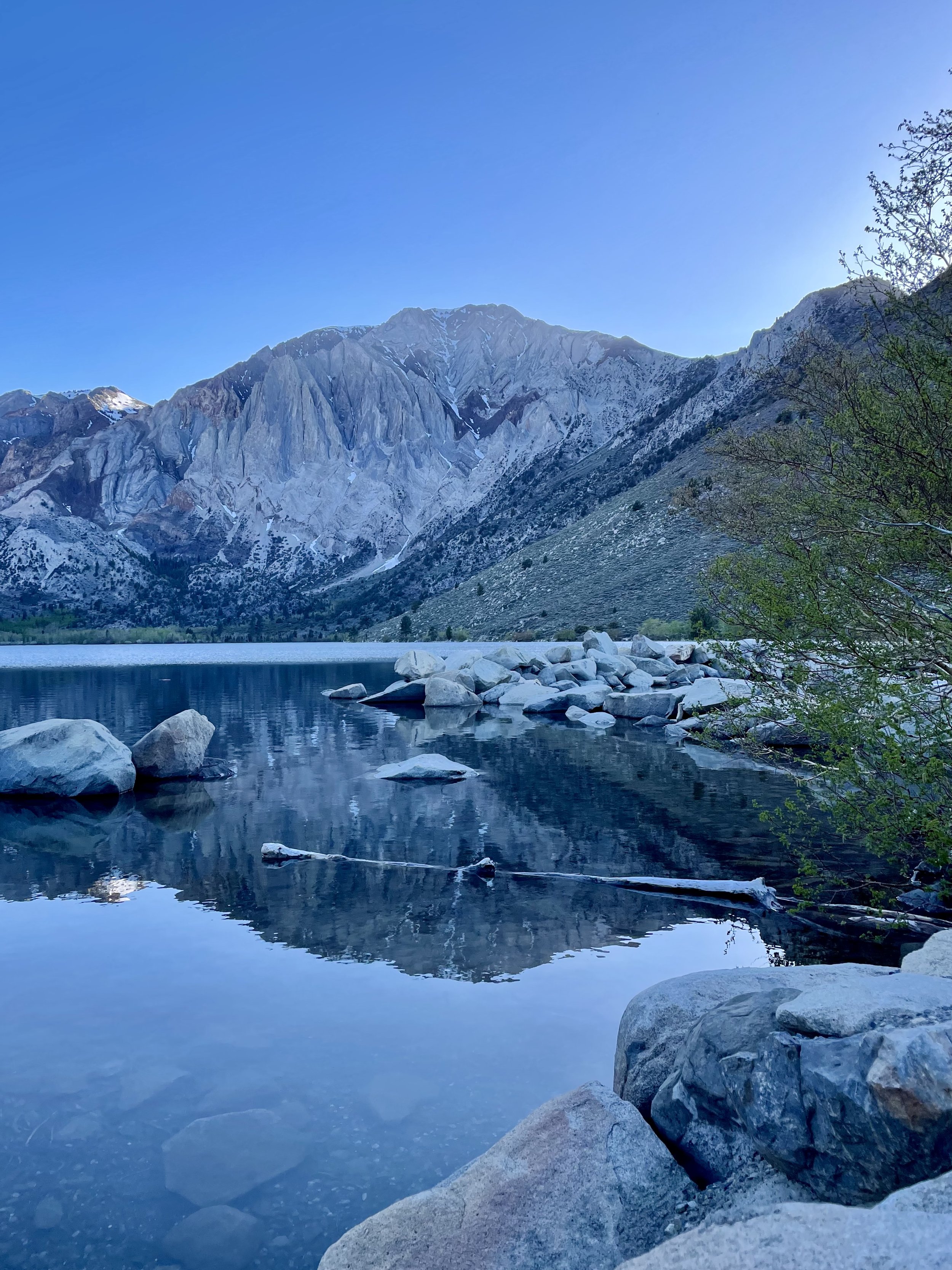
After my trek through Nevada, I finally made it to Mammonth Lakes and met up with Eric at Distant Brewing. Then we headed to Twin Lakes to explore but could only get as far as the bridge due to a road closure. We decided to head south to Convict Lake, a stunning oblong-shaped lake with turquoise-blue clear water, boxed in by the steep backdrop of the Sierra Nevada, and highlighted by the 12,241’ Mount Morrison. Convict Lake was originally carved out by glaciers, and at up to 140’ deep in some places, it’s one of the deepest lakes in the region. This lake has an interesting history that changed its name from its traditional Mono name of Wit-sa-nap by American settlers. From there, Eric and I headed to Hilltop Hot Springs for a soak, one of our favorite spots in the area. This is a popular spot and can be quite crowded as it only fits about 8 people, but luckily there was enough room for us and we joined a fun crew of college graduates already in this 2 feet deep heavenly tub. A wonderful lady named Mary joined us a bit later and we instantly became friends. Lots of laughter ensued as the whole group bonded for the next few hours, watching the sunset over the mountains in the distance. Mary decided to join me and Eric for a fire pit by our vehicles and we decided to spend the night there, even though you’re technically not supposed to.


The next day I headed north to Mono Lake, an ancient saline lake that covers over 70 square miles and supports a unique and highly productive ecosystem, I spent some time exploring the South Tufa area where some of these remarkable tufa rock formations towered over me. I continued north up CA Route 395, probably one of the most scenic highways you can travel and one of my favorites, through Bridgeport and the Walker River Canyon, past Topaz Lake into Nevada, then back into California passing by Eagle Lake and through the Modoc National Forest (with some great views of Mount Lassen), and finally into Oregon. The last stretch of driving was along Upper Klammath Lake and onto the Willamette HIghway to McCredie Hot Springs. I did what most tourists do and went to the day use area and walked along the path to Salt Creek. Turns out you need to take a different road to actually get to the hot springs which are on the other side of the river, so be sure to follow these directions if you plan to visit. Since I didn’t make it to the springs, I left after my short hike and found a cool turnoff further down the road where I spent the night next to Salt Creek under the highway.


I woke up on the 10th and last day of this road trip and headed the rest of the way home, driving past Lookout Point Lake and Dexter Reservoir (both look like places to enjoy in the future), into Eugene, and then north up I-5 through Salem and the 45th Parallel. I made quick stop in Seattle to meet another Clubhouse friend named Mark who showed me the view of the Seattle Skyline from the top of his building. Then I drove then final stretch home to Bellingham. It was an eventful journey full of new explorations and new friends that I’ll always treasure!


